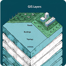
Sandbox Service
Sandbox Service provides a controlled environment for testing, innovation, and experimentation in the geospatial domain.
Sandbox Service provides a controlled environment for testing, innovation, and experimentation in the geospatial domain.
Submit your organization’s application to join the Sandbox Service environment.
Your submission is reviewed by GEOSA for eligibility and innovation criteria.
Upon approval, you gain access to testing tools, APIs, and datasets.
Develop and experiment with your geospatial solution inside the Sandbox.
Receive feedback and recommendations to enhance your product for potential rollout.

Sandbox Service helps organizations explore and test geospatial solutions safely.

Startups, private companies, researchers, and academic institutions working on geospatial technologies are welcome to apply.

Participants gain access to testing tools, open datasets, technical support, and feedback from experts to refine their solutions.
Renewal request must be submitted at least 60 days before the permit expires
You must notify the authority of any changes in the establishment's data
Ensure compliance with technical competency requirements for each activity
Commercial establishments
3 working days
Access important documents to help you comply with the Sandbox requirements and understand our technical and operational guidelines.
Centimeter-accuracy mapping applications

Advanced and autonomous navigation technologies

Panoramic imaging and virtual reality solutions

Advanced analytical solutions for geospatial data


Providing comprehensive and integrated solutions in the field of geospatial information, from data collection to the development of innovative applications and services.

A specialized team of experts in the field of surveying and geospatial information with more than 25 years of accumulated experience in the sector.